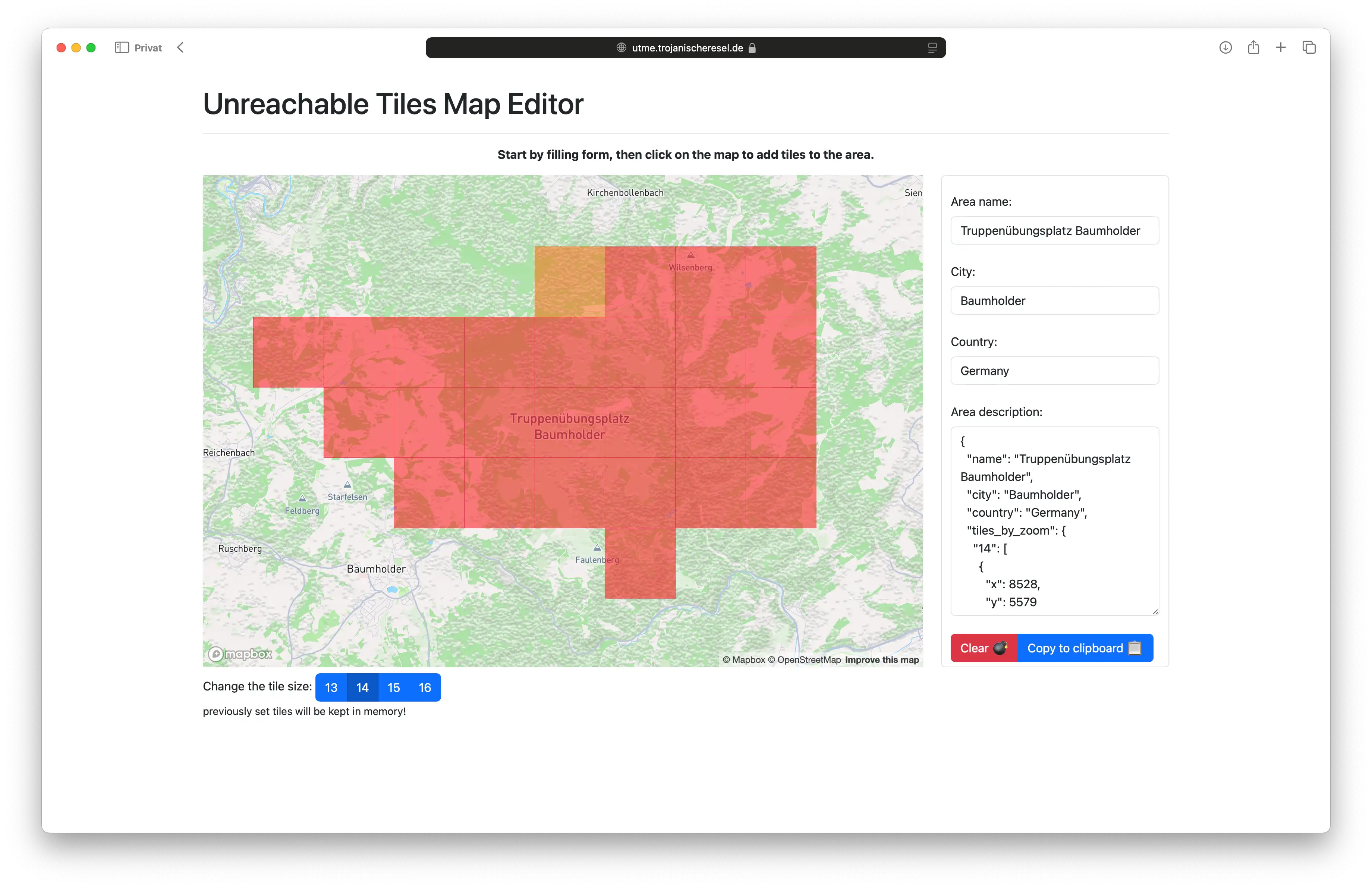
A simple map editor for unreachable tiles
👋 This tool is here to help you create a set of unreachable tiles for an area.
You can define these areas simply by clicking on the map.
The tiles you define will be saved in a JSON file and can be submitted/added to the existing set of unreachable
tiles.
Privacy notice / Cookie consent
You must accept technical cookies to be allowed to proceed!
This project uses the 3rd party service Mapbox to display the map. By clicking the button below, you accept the use of technical cookies. You allow this app to interact with the Mapbox service, with all the implications that come with it. This may include tracking your usage of the map, as well as other data, like your IP address.
You will be asked for your position to center the map on your location. This is an optional feature and you can deny the request, of course.
FAQ
What is this?
This is a tool to help you create a set of unreachable tiles for an area.
What's the purpose?
Exploring the world tile by tile is fun, yet there are areas you cannot reach. This tool helps you visualize these areas. You can define them click by click.
What is unreachable?
It's about permissions or legal restrictions. Just because you only track bike rides, it doesn't mean you could walk, swin or boat somewhere.
Unreachable means that something isn't publicly accessible. It could be a private property, a military area or a nature reserve. Or any other reason why the public is not allowed to enter (👽🛸).
There are some areas defined already, why can't I change them?
This project is hosted for our purpose. The areas defined as unreachable are matching our needs. If you need to define your own areas, you can visit the project on GitHub and deploy your own instance.
Just edit the unreachable_tiles.json file and run/deploy the project for yourself.